Tokyo's Geography
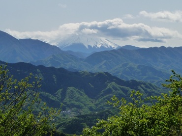
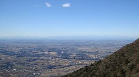
This picture shows Mt. Takao and the mountain ranges of the West Side of Tama.
This picture shows Mt. Takao and the mountain ranges of the West Side of Tama.
Tokyo Geography
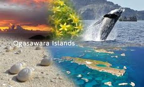
These islands are the Ogasawara Islands. The islands are full of sandy beaches and lots of marine life.
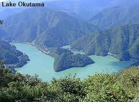
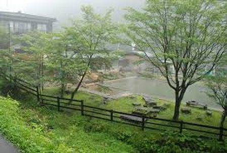
This is Lake Okutama located in the Western Side of Tokyo also known as Tama. The lake's water is used for agriculture, drinking, and recreational use.
These are the hot springs of Nasu Osen. They are located on the slopes of the Nasu Mountains.
This is the Tama River and it is one of the few rivers that run through Tokyo. It is located within the Western Side of Tama.
This is the Kanto Plain. It is what part of Tokyo sits on.
|
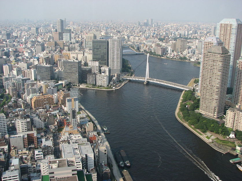
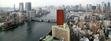
Tokyo has different types of geography. Tokyo is divided up into many divisions. The city has natural land-forms such as valleys that help show their geography and specific borders. Tokyo also has different climates like rainy and sunny days. Tokyo is divided up into many divisions to isolate certain areas for a purpose. For example, Tokyo doesn't have the metropolitan area right next to a farm because it is just wasting space. The space where the farm would go could be used to build tall buildings that sponsor the idea of trade. To start off with, the business-full area, otherwise known as the metropolitan area, is Tokyo’s center. It was made up of 23 wards also known as divided areas. The central area of Tokyo is earthquake prone meaning that the place is a common area for earthquakes to be occurring. In the central area, some districts are business centers. Koto, one of the 23 districts, has many trees and forests. (Tokyo, Geography, 15 March 2015) Also, two rivers run through Koto. Most of Tokyo is located on the Kanto Plain which is right next to the region of Chubu and Tohoku. It is one of the three largest cities. As you can see, the 23 wards of Tokyo are pretty busy. Another very important geographical-full area is the Western Side of Tokyo otherwise known as the Western Side of Tama. This means that most of the geography that makes Tokyo famous is within this area. To start off with, Tama includes 26 cities, 3 towns, and a village (Tokyo and Tokyo Only, 13 April 15) the area is well known for the large number of universities. The Area of Tama also has many types of woodland. Adding to this, Tama has many water sources like streams, lakes, and rivers. These water sources feed crops; some sources are used as drinking water, and recreational purposes like boating. Tama is mostly known for Lake Okutama because the lake is in Chichibu Tama National Park which is the closest park to the metropolitan Tokyo area. It is also known for its beautiful panoramic view which attracts many tourists every year. The Western Area of Tama is pretty rocky with mountains like Mt. Takao and Mt. Mihara. (Tokyo, Japan, 15 March 2015) Ultimately, the West side of Tokyo has many nice geography features like water sources and mountains. There are a few islands that make up part of Tokyo, but the Izu and Ogasawara Islands make up most of Tokyo that are on small on islands. This is so because many other island chains are almost uninhabitable, lack certain resources, or are just too far away from Tokyo itself. These islands only cover about 252 square miles which is pretty small. The Ogasawara Islands are 621 miles south of Tokyo. The islands have a lot of marine life like Eye stripe surgeon fish and coral reefs. The islands are full of green vegetation. The islands consist of 2 towns and 7 villages. Due to the isolation from each other, they towns and villages are not as advanced and little progress is made. There are few people and the population density is low. Being that this is so, the only money villagers will make is by selling fish. The Izu and Ogasawara Islands are what really make up the majority of Tokyo on small islands. There are many areas within a 150 mile range of Tokyo that are spectacular displays of Tokyo geography. The Nasu Heisei-no-mori forest is a forest that is 112 miles away from Tokyo. It surrounds the Nasudake Mountain Ranges and is located within the Nasu Onsen . The forest is about 1,400 square miles and is located in the Tochigi Prefecture which is one of the seven prefectures. The Nasu Heisei Forest has many rare species like the Japanese Crane that only reproduces in Hokkaido. The forest contains many pine and cedar trees which are the most common trees in Japan. Tokyo has a few different types of climates. In fact, it has 4 seasons. The summers are hot and the winters are cold. In the spring and fall it is a cool temperature. It has still been like this for 30 years. To summarize this up, Tokyo has a subtropics climate with some occasional rain. In the early summer, a lot of rain occurs and in late summer, that’s when the typhoons start coming. Tokyo has four distinct seasons and has a subtropics climate on average. In conclusion, Tokyo has different types of geography in different areas like large mountains or small streams. Tama is probably the best example of geography due to its large mountains and lakes. Tokyo’s geography had a great influence on peoples’ lives. |